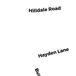
25 HILLDALE RD
Owner Information
WENTWORTH CHARLES H
25 HILLDALE RD
ASHLAND, MA 01721


Property Details
25 HILLDALE RD is classified as a Single Family Residential (Rn).
The primary structure on this property was built in 1955. There are 1,328ft2 of built area within this property. There is 1,328ft2 of residential/living space within this property. This property is listed as having 8 rooms.
25 HILLDALE RD is valued at $449,900. The land is valued at $223,400 and the structures are valued at $226,500. There is an additional valuation of $29,460 on this property.
This property is in Zone R1. Confirm with local Zoning Board authorities to ensure there are no overlays or other easements on this property.
The most recent deed for 25 HILLDALE RD is recorded at the local registrar in Book 69123, Page 0330. 25 HILLDALE RD was last sold on Tuesday, April 11, 2017 for $432,000.
Assessment data from fiscal year 2022.
Flood Data
According to the FEMA National Flood Hazard Layer, this property does not appear to be in a flood zone. It may also be in an area not yet reviewed. Nonetheless, confirm this information prior to taking any action.
To view the flood hazards around this property, create a FEMA "Firmette" Map of the area around 25 HILLDALE RD.
Broadband Internet Providers
| Provider | Type | Bandwidth (mbps) | |
|---|---|---|---|
| T-Mobile | Fixed Wireless | 25 | 3 |
| Viasat Inc | Satellite | 100 | 3 |
| GCI Communication Corp. | Satellite | 0 | 0 |
| HughesNet | Satellite | 25 | 3 |
| VSAT Systems, LLC. | Satellite | 2 | 1 |
| Comcast | Cable | 1000 | 35 |
| Verizon New England Inc. | Fiber | 940 | 880 |
Broadband service provider data from December 2020.
Adjacent Properties
- 19 HILLDALE RD
Single Family Residential owned by MARTIN CARMEN M - 0 GREEN ST
Undevelopable Residential Land owned by FELDMAN MARY A - 46 GREEN ST
Single Family Residential owned by FELDMAN MARY A - 50 GREEN ST
Single Family Residential owned by BLYTHE ELIZABETH H - 56 GREEN ST
Single Family Residential owned by DONLON MARK J - 27 HILLDALE RD
Single Family Residential owned by GARTSIDE ERIC M